Forget El Nino, StormFest is about to Hit the West Coast

TLB Editors Note: In the following look at the weather, there is no mention of The GeoEngineering Programs that are in place by the writer Cliff Mass or in the comments at the bottom of his original post. Anyone surprised? It will be interesting to see what the Weather Modifiers will do with this over abundance of moisture. (~TLB)


Forget El Nino, StormFest is about to Hit the West Coast

by Cliff Mass

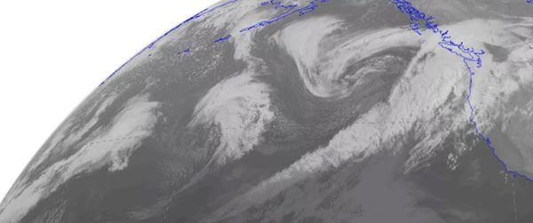
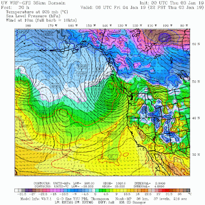
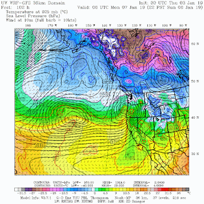
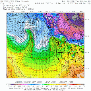
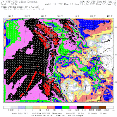
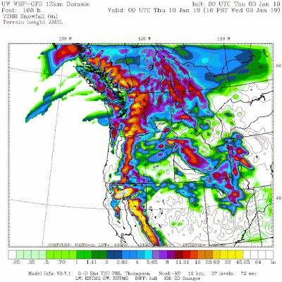
Things often calm down after January 1 during El Nino years….but not this year…with the U.S. West Coast from central California to Washington State about to be pummeled by a series of storms.   Rain, snow, wind?  Plenty for everyone.

A view of the latest infrared satellite imagery shows an amazing line-up of one storm after another stretching way into the Pacific.  A traffic jam of storms.

Let’s examine our stormy future, using a series of sea level pressure forecasts from the UW WRF weather forecast models (solid lines are sea level pressure, shading in lower atmosphere temperature).
At 10 PM today, a  strong low is just off the northern tip of Vancouver Island.
10AM Saturday brings an energetic low center into northern CA.
10 PM Sunday?   Another storm hits central Oregon!  And another system is in the wings.
That storm is right off our coast late Wednesday.
El Nino late winters generally have less action—not so this year!  
What about precipitation you ask?   Do you really want to know?  The accumulated total through 4 AM next Thursday is impressive, with 5-10 inches over many mountain areas and even 10-20 inches over parts of northern CA, the Olympics and southern BC.
 
Snow?   There will be abundant amounts.   For example, here is the accumulated snowfall for the 72 hours ending 4 PM Wednesday.  2-3 feet for the high terrain from the central Sierra Nevada to southern BC.  Our winter ski season is secure.
Wind?  You bet.  Each of these storms will bring strong, damaging winds to a favored area of the coastal zone and mountain peaks.
 
There is a silver lining of all this action of course:  it will provide an immense amount of water to fill our reservoirs and enhance our snowpack, a snowpack that is now in pretty decent shape (see latest summary below).  Water resources should be fine next summer.

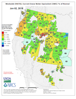
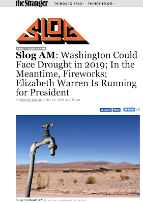
But all these facts on the ground and favorable forecasts don’t stop some of Seattle’s wacky local media from talking about drought for our region, with the Seattle Stranger being one of the worst (see below).  Facts should matter—apparently not at the Stranger.

*********

(TLB) published this Weather Report from Cliff Mass Weather and Climate Blog.

About the Author Cliff Mass

••••

The Liberty Beacon Project is now expanding at a near exponential rate, and for this we are grateful and excited! But we must also be practical. For 7 years we have not asked for any donations, and have built this project with our own funds as we grew. We are now experiencing ever increasing growing pains due to the large number of websites and projects we represent. So we have just installed donation buttons on our main websites and ask that you consider this when you visit them. Nothing is too small. We thank you for all your support and your considerations … (TLB)

••••

Follow TLB on Twitter @thetlbproject


Be the first to comment

Leave a Reply

Your email address will not be published.


*